PART II
The Kitamaebune
The system that built the wealth. A ship, a route, a financial game.
PART II — THE KITAMAEBUNE
2.1
Origins of Northern Trade
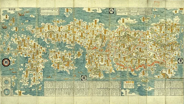
Ishikawa Ryūsen, 'Nihon Kaisan Choriku Zu' (Map of Japan's Seas, Mountains, and Land Routes), c. 1691. Woodblock print. One of the earliest commercially published maps of Japan, produced during the same decade Kawamura Zuiken established the northern shipping circuits. Public domain.
In 1670, a merchant named Kawamura Zuiken received a commission from the shogunate: find a faster way to move northern rice to the capital.
The Architect of a System
He surveyed the entire coastline, built lighthouses, established weather stations and waiting protocols. By 1672, two routes were operational: the eastern circuit and the western circuit. A national-scale supply chain, built by merchants — comparable to the Hanseatic League.


 Hakodate Hachinohe Sakata Arahama Niigata Kashiwazaki Tsuruga Hyogo-tsu Osaka Edo
 The two routes established by Kawamura Zuiken, 1671–1672.
The Golden West
The sea route connecting Osaka — 'the kitchen of the nation' — to Hokkaido became the most efficient supply chain in pre-industrial Asia. Herring became fertilizer. Kelp became the backbone of umami. Rice became currency.
In the European reader's vocabulary, the closest parallel is the Hanseatic League.
Japan's Hanseatic League
The kitamaebune network was built not by the state but by merchants. It operated without formal government oversight, held together by custom, contract, and trust. For two centuries, it was Japan's Hanseatic League.